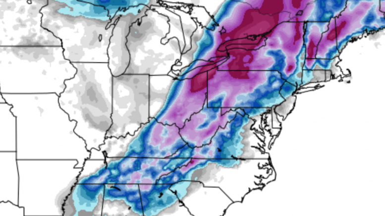
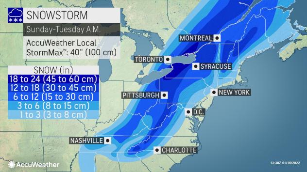
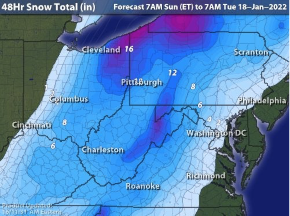
For the first time in 2022, a major snowfall is expected in Western Pennsylvania. This is one of the more complicated forecasts in recent memory, as although mixing precipitation is not forecast to be a factor around Pittsburgh, there is a large dry slot expected to open up east of the city. Depending on exactly where this slot forms and how long it lasts can be the difference between 6″ and 18″ of snow.
Another complication of this system is the expected accumulation difference between central and western Allegheny County. As a reminder, the official storm measurement will be taken near the airport at the Moon Township office of the National Weather Service. Therefore, we are documenting the forecast snowfall totals for Moon, not for downtown Pittsburgh. This is a factor on most of the forecast maps, with some outlets calling for more snow in the city and less in Moon, and others saying the opposite.
AccuWeather: 6-12″
Intellicast: 12-14″

NWS Pittsburgh Range: 12-18″
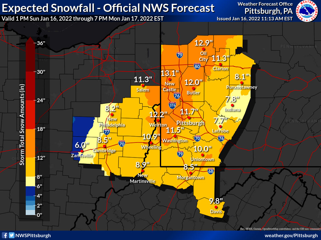
NWS Pittsburgh Point
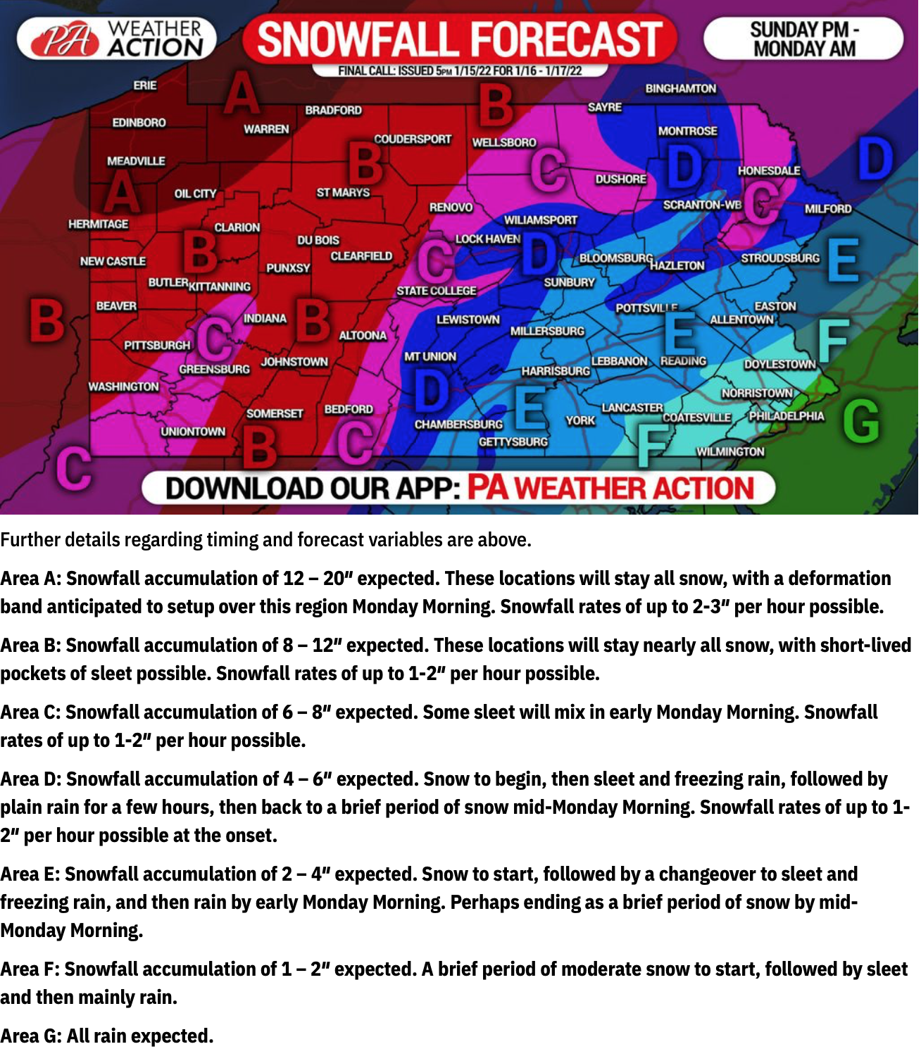
PA Weather Action: 8-12″
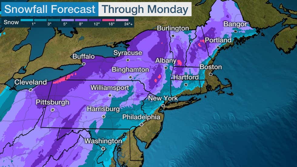
Weather Channel: 8-12″
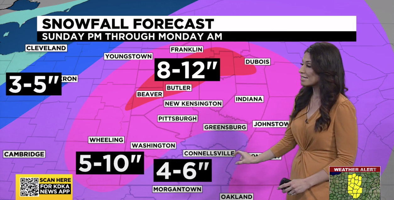
KDKA: 5-10″
WPXI: 5-9″
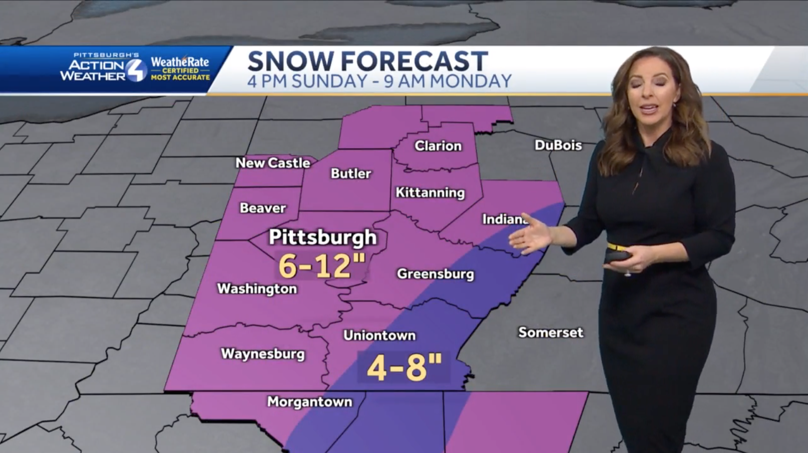
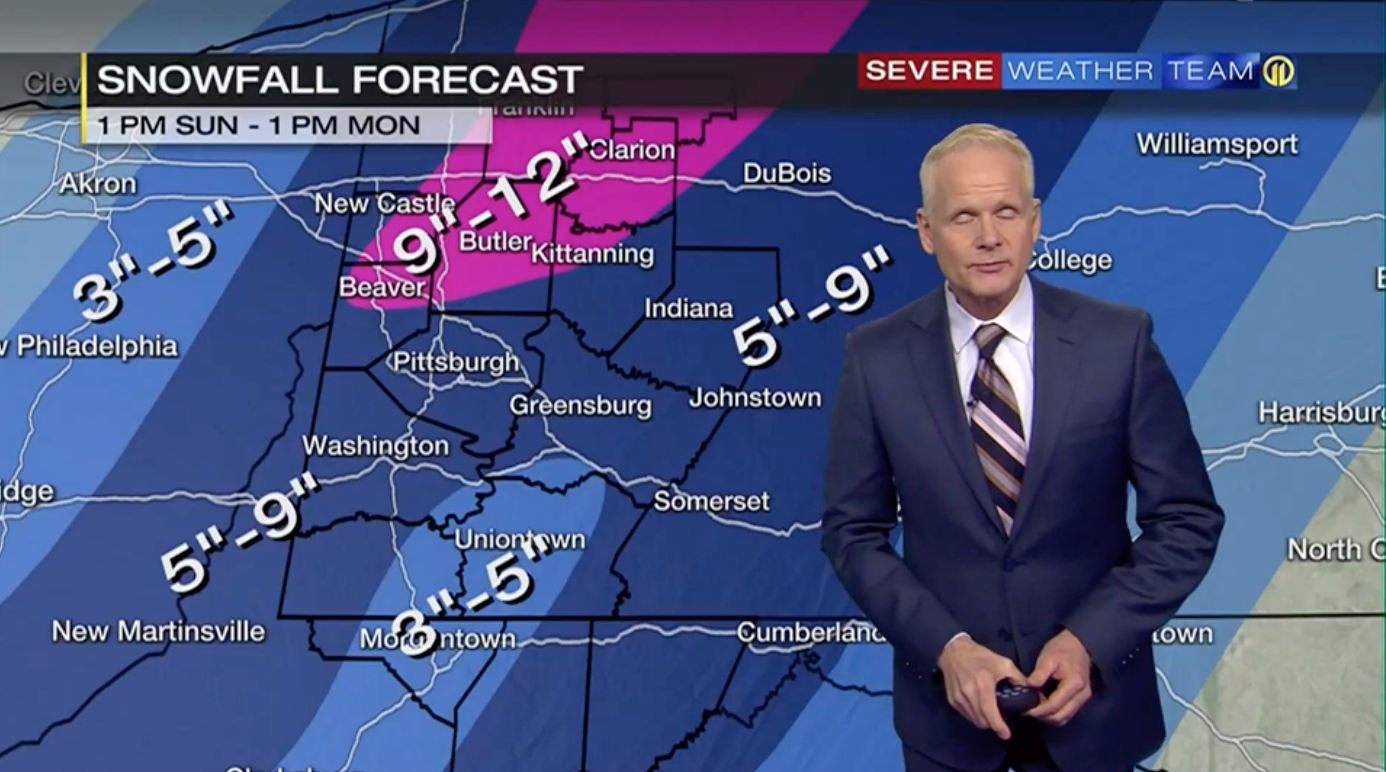
WTAE: 6-12″
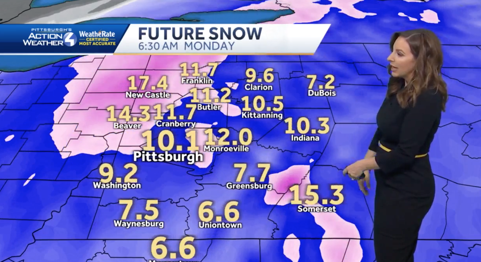
WTAE Futurecast
Be the first to comment on "January 16th Major Winter Storm Forecast Roundup"