Every time a snowfall is predicted, local and national media outlets will use various computer models to generate their accumulation forecasts. We will be saving and tracking these maps all winter long with a goal of determining which media network is the most reliable in predicting snowfall. Normally, our commentary will describe the map’s successes and failures, then we will assign an Accuracy Score on a 0-10 whole number scale. We will average each agency’s Accuracy Score throughout the winter and keep an updated rankings list at the bottom of each Forecast Analysis post. It is important to note before we get into the post that this analysis is for Western Pennsylvania. Many of these maps also have predictions for many other parts of the Mid Atlantic and Northeast, but know our discussion is only referring to the areas in and around Western PA.
Our analysis will use official snowfall totals from the National Weather Service’s Pittsburgh Office, tweeted publicly at @NWSPittsburgh. This post would not be possible without the hard work and dedication of the NWS Pittsburgh office, which worked through the night to compile hundreds of snowfall reports. NWS Pittsburgh Official Total: 3.2″
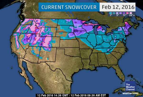
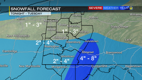
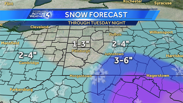
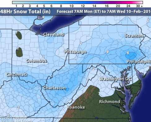
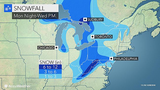
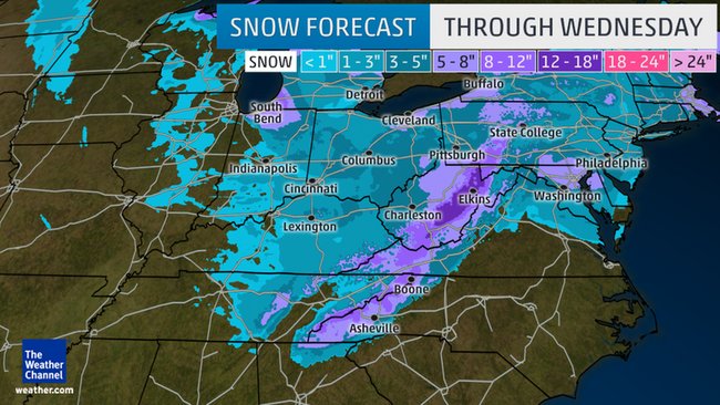
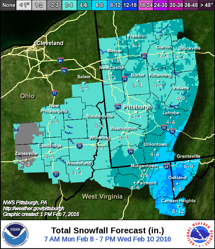
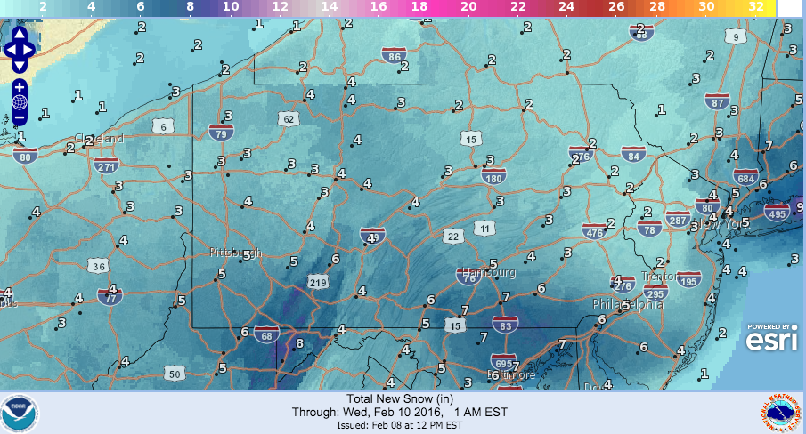
Normally, our Forecast Analysis compiles the NWS snow totals onto a map. This was not possible for this storm, as the snow ranged from Monday through Thursday, and storm total reports were hard to judge. In addition, this analysis will not assign accuracy scores, because some maps on this page just predicted the snow from Monday through Tuesday, and others Monday through Thursday. It simply would not be fair to judge the successes of forecasting a storm that did not stop for four days. So, just this once, everyone is off the hook. Here’s the maps for your reference:


Be the first to comment on "Forecast analysis for Feb. 8-11 snowfall"