As much of the meteorological world focuses on the potential for heavy snow in the southern United States this weekend, here in Pittsburgh we are preparing for a few inches of our own. A fast moving wave will bring a general coating to 2″ of snow to the area between lunchtime today and late this evening (The National Weather Service’s Pittsburgh office is calling for the heaviest snow to arrive between 1pm and 3pm, while WTAE-TV predicts the worst of it to arrive at 6pm). Below are the snow maps for today’s accumulation; be sure to check back with us tomorrow morning as we assign accuracy scores to the maps in order to update the Forecaster Ratings.

KDKA is forecasting 1-2″ for the city of Pittsburgh, with higher accumulations just south.
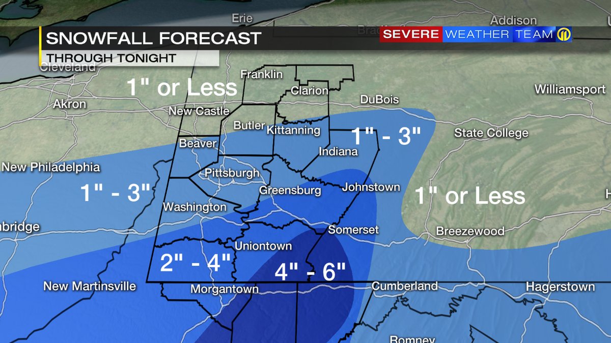
WPXI is calling for 1-3″ in all of Allegheny County
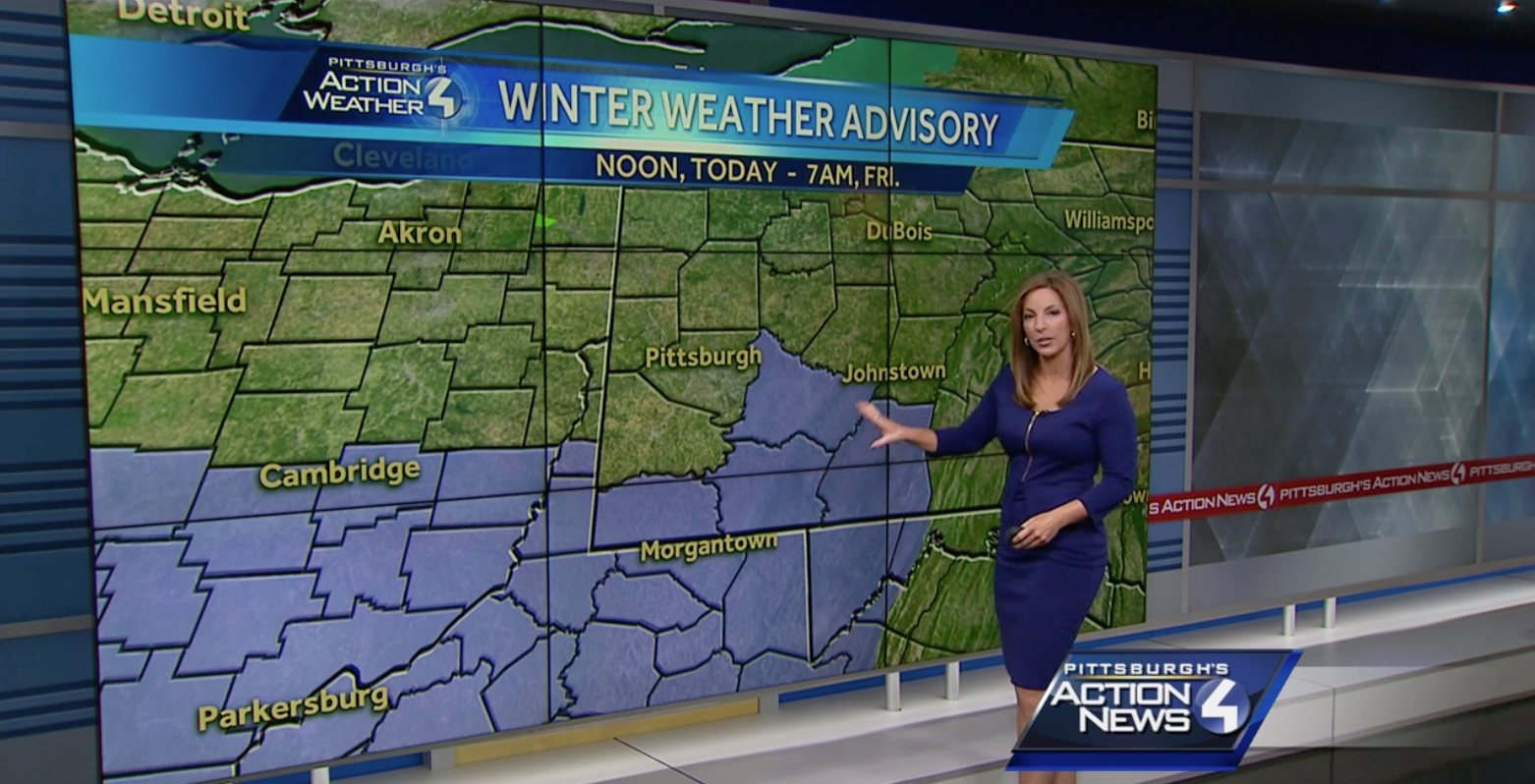
WTAE did not publish a snow map for this storm online, nor did they broadcast one on their morning newscast. They did use the Winter Weather Advisory map, saying 1-2″ for areas not under the advisory, and 2-3+ inches in those under the advisory.
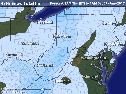
Intellicast is calling for 1-2″ west of Pittsburgh in Allegheny County, and 2-3″ east of the city.
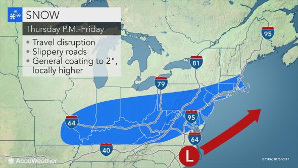
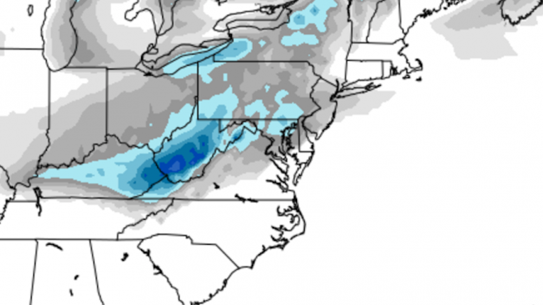
AccuWeather did not publish a full snowmap for this storm, but is instead using this general map to predict C-2″ in the shaded areas.

The Weather Channel is forecasting 1-3″ in Pittsburgh
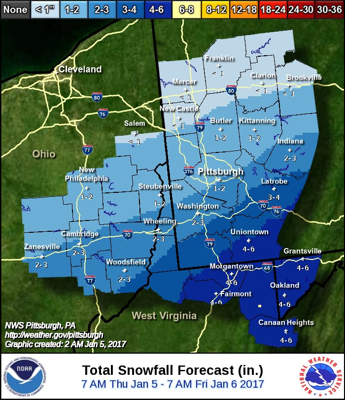
NWS Pittsburgh is putting their line right through the city, predicting 1-2″ north and 2-3″ south.
The NWS Digital Model is calling for 2″ in the city.
Be the first to comment on "Forecast Roundup for Jan. 5th light snow event"