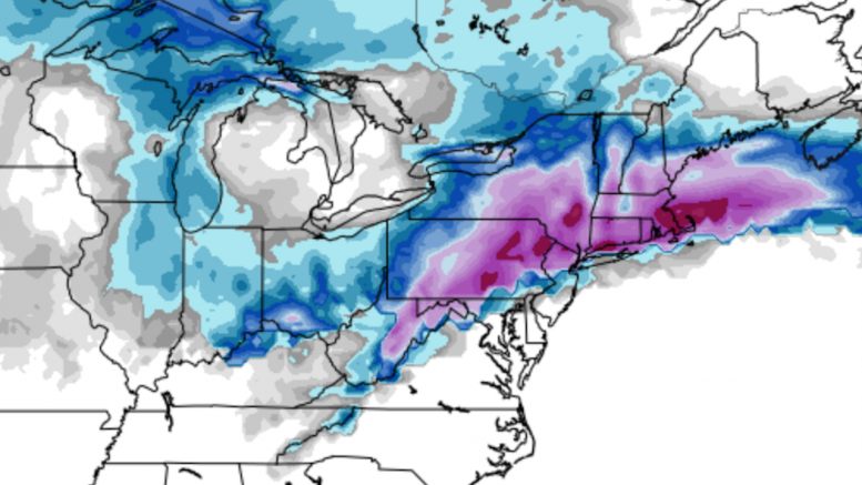
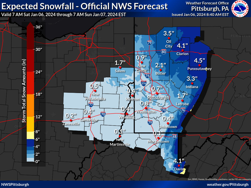
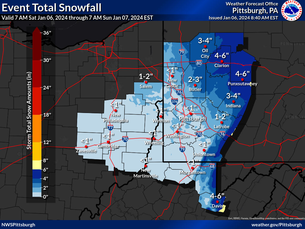
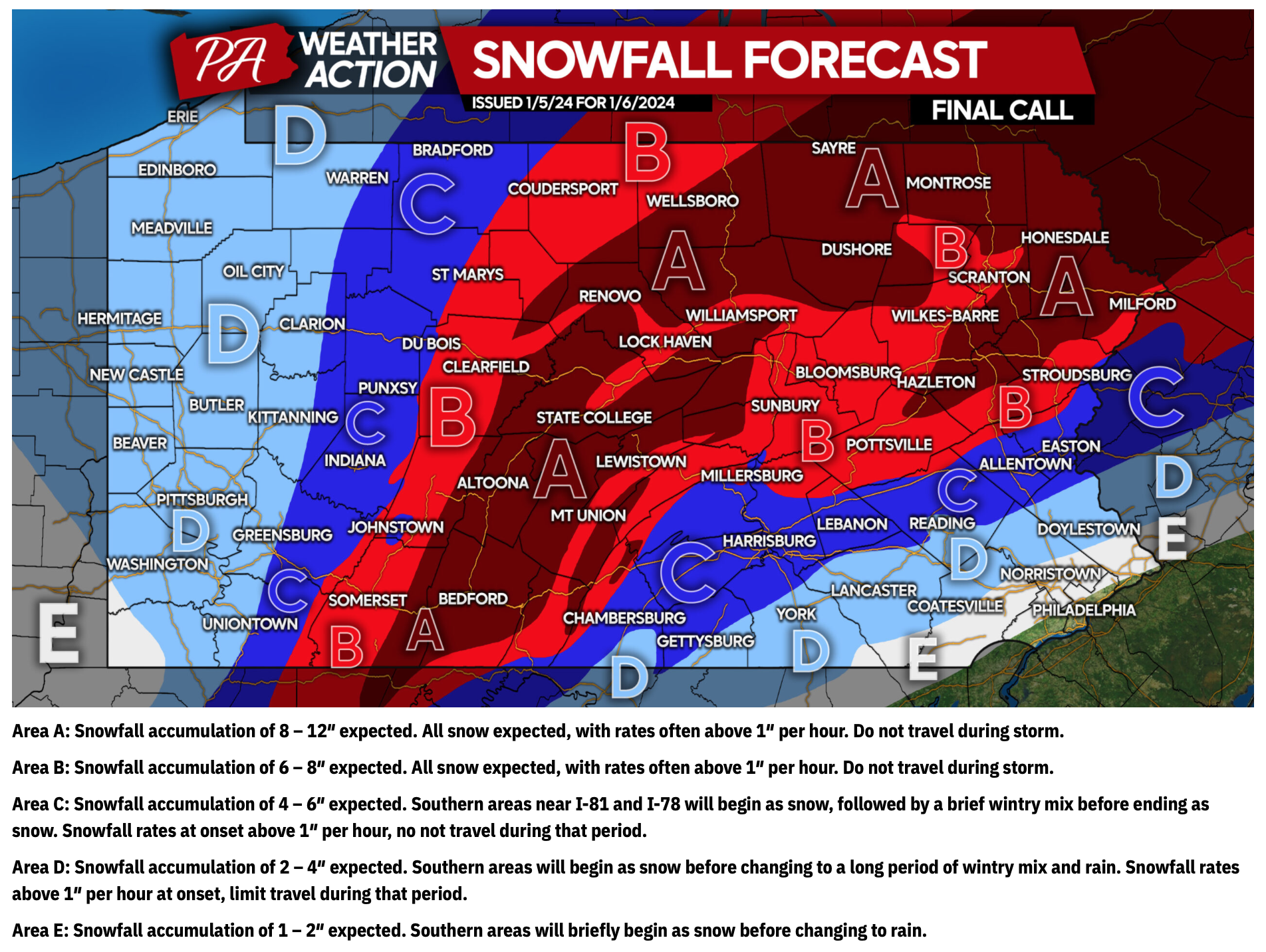
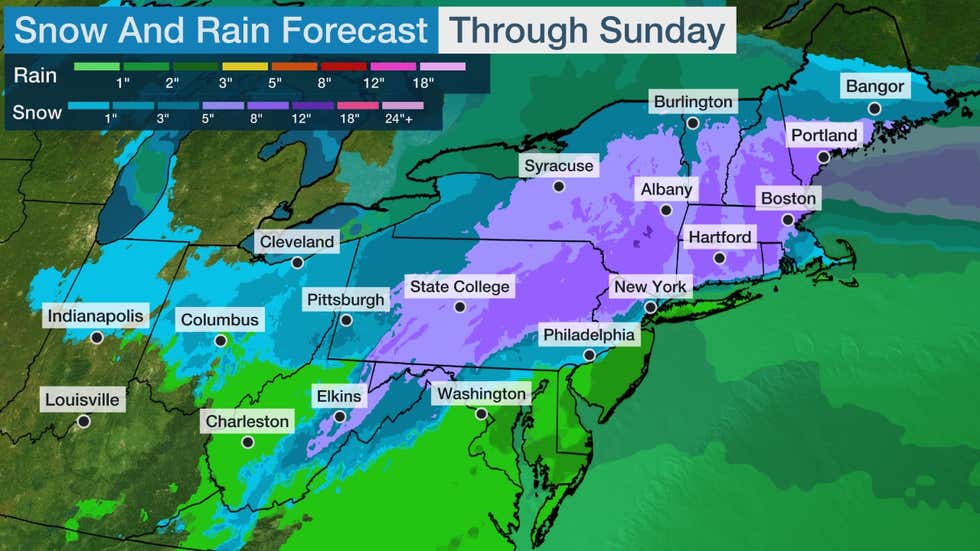
The first major winter weather event of the 2023-24 winter season is upon us. Despite weather models earlier in the week calling for blockbuster snowfall amounts in Western PA, the forecasts evolved as the system came ashore on the west coast and now predict a rather minor event.
There is continuing uncertainty on how far north the rain/snow line will advance. If there are several hours of mixing (or rain) at the start of precipitation, the total snowfall amounts may be even lower than currently forecast.
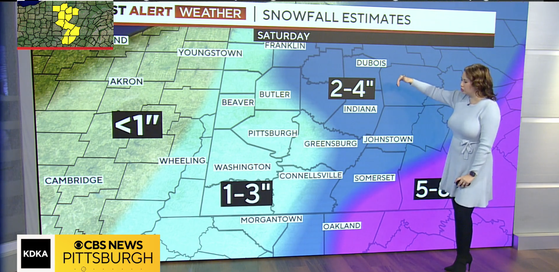
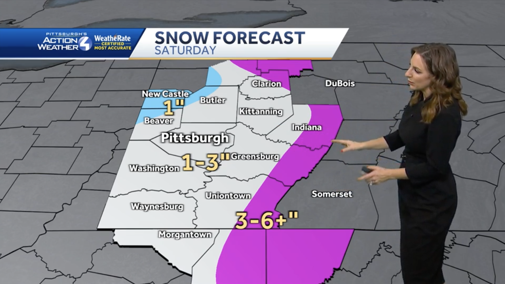
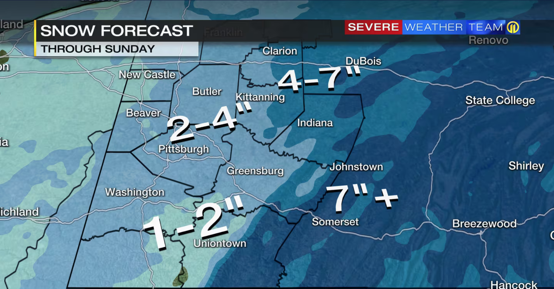
For each snowfall event, we publish a Forecast Roundup with the final forecasts from the outlets we track. After the last flake falls and the official snowfall total is recorded by NWS Pittsburgh, we publish a Forecast Analysis with the error of each forecast. At the end of the season, all of that data is combined into an overall average error for the season, which impacts each outlet’s Forecaster Ratings.
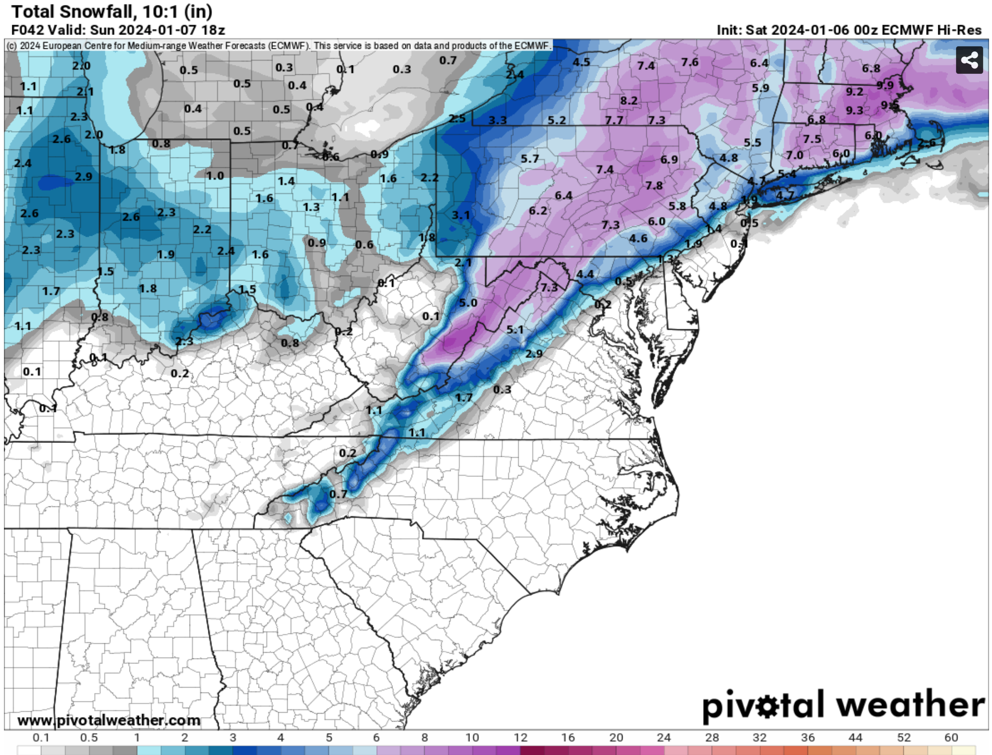
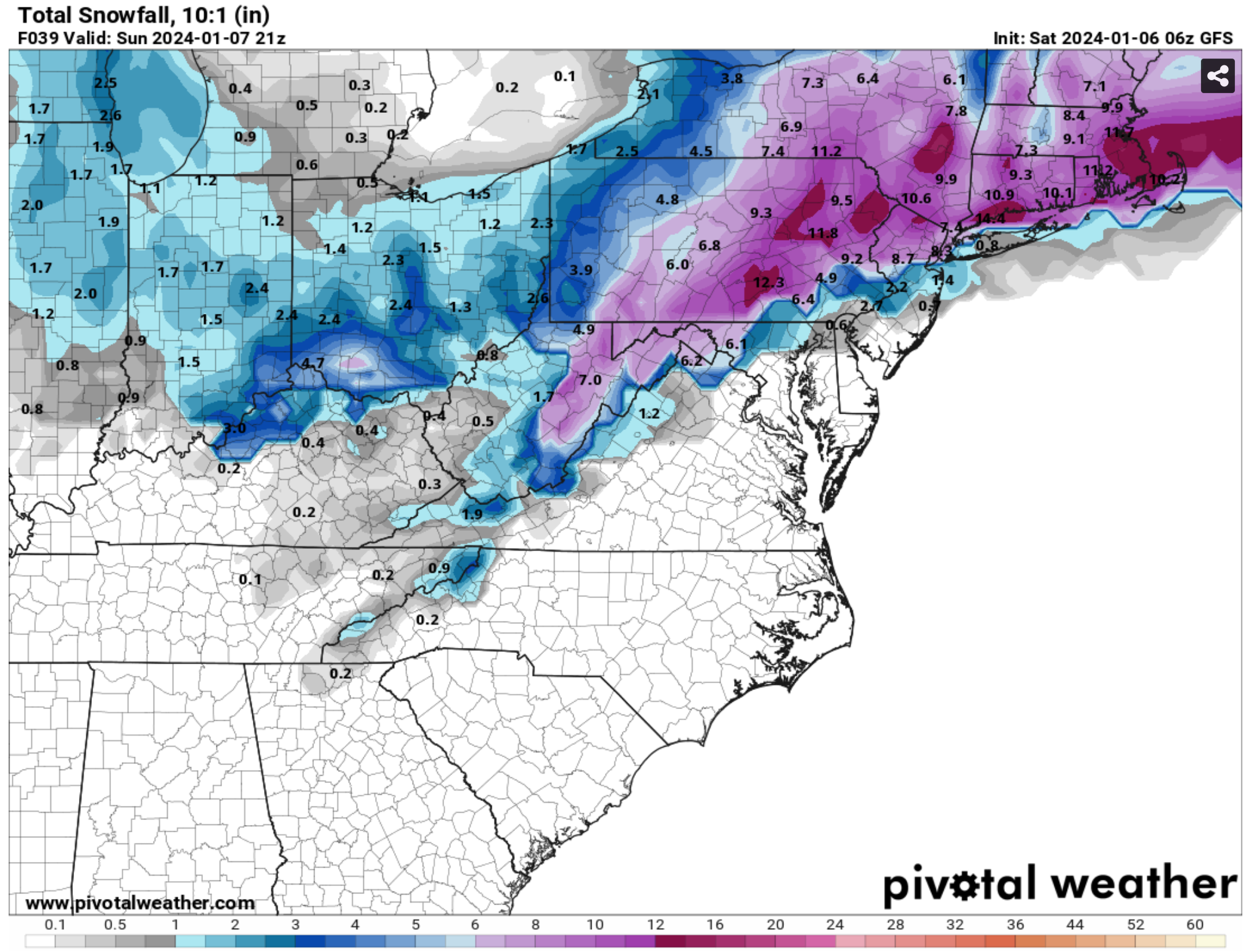
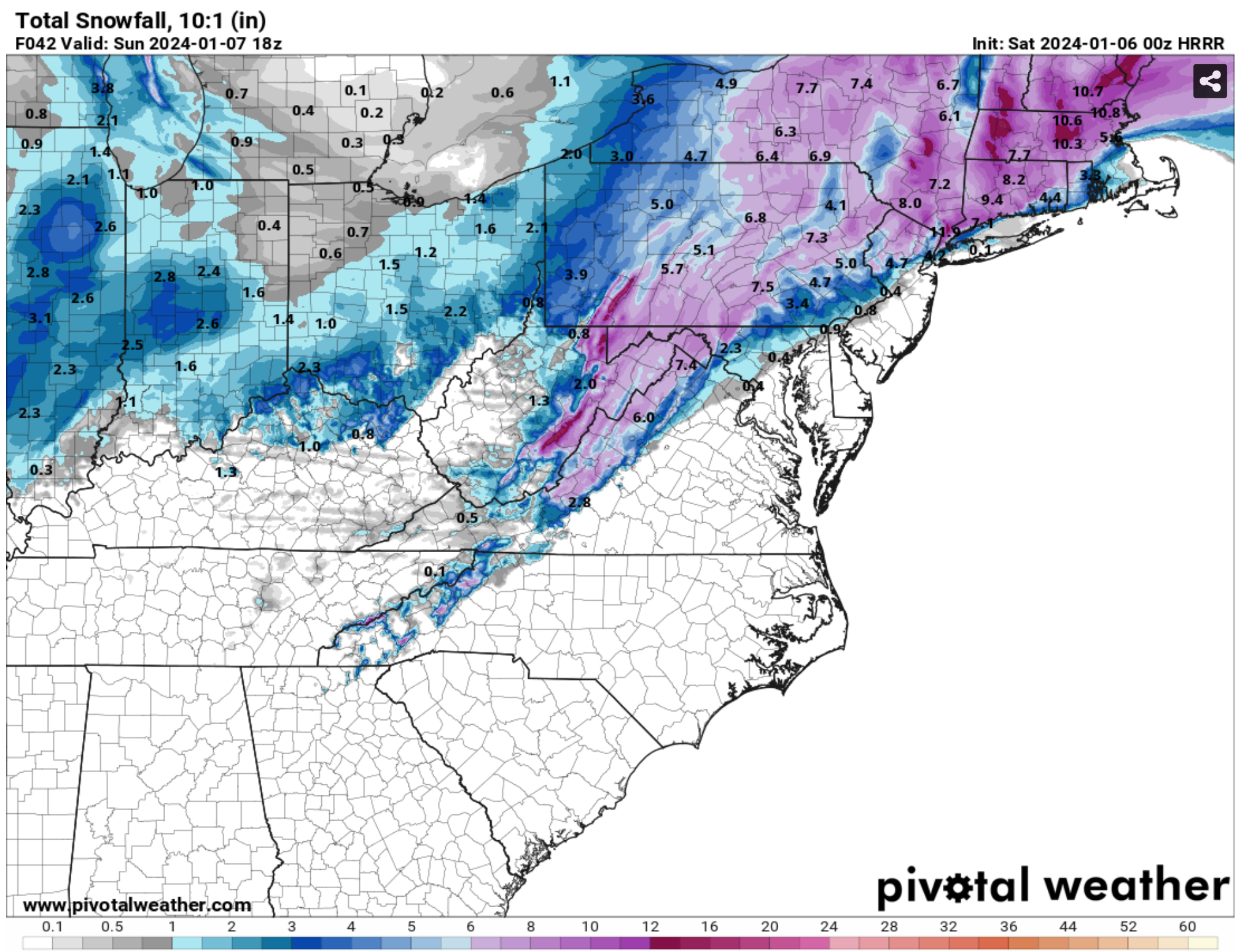
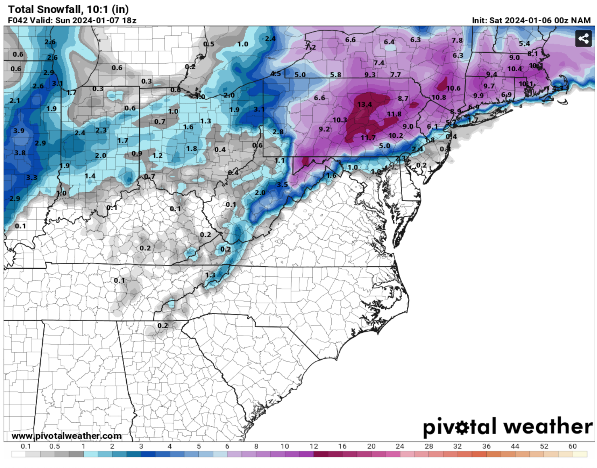
Note that the official measurement for Pittsburgh is recorded by the NWS Pittsburgh office in Moon Township. Therefore, we take the forecast of that location on the below maps, which can differ from the forecast for downtown.
We’re also documenting model outputs for the first time: GFS, Euro, NAM, and HRRR, courtesy of Pivotal Weather.
Be the first to comment on "January 6th Winter Storm Forecast Roundup"