For each snowfall event, we publish a Forecast Roundup with the final forecasts from the outlets we track. After the last flake falls and the official snowfall total is recorded by NWS Pittsburgh, we publish a Forecast Analysis with the error of each forecast. At the end of the season, all of that data is combined into an overall average error for the season, which impacts each outlet’s Forecaster Ratings.
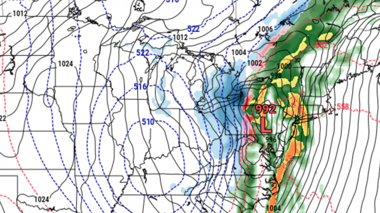
Note that the official measurement for Pittsburgh is recorded by the NWS Pittsburgh office in Moon Township. Therefore, we take the forecast of that location on the below maps, which can differ from the forecast for downtown.
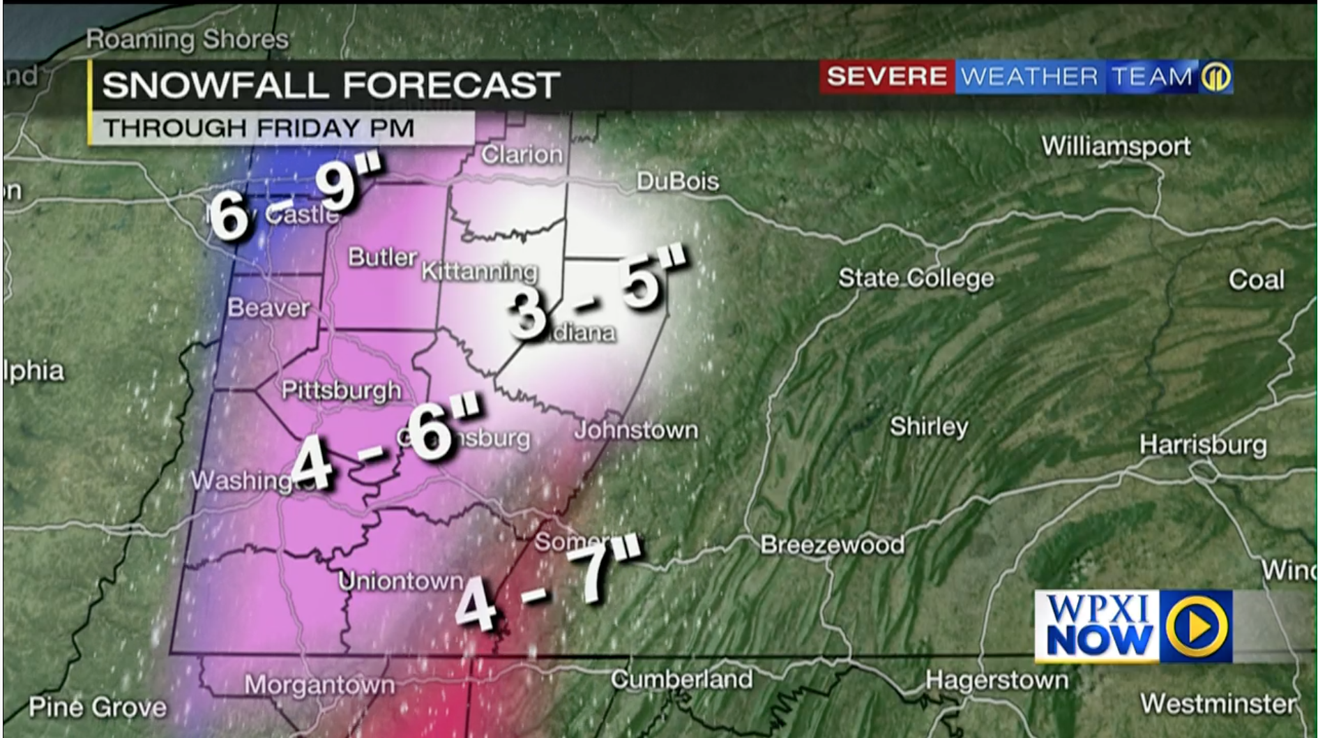
WPXI: 4-6″
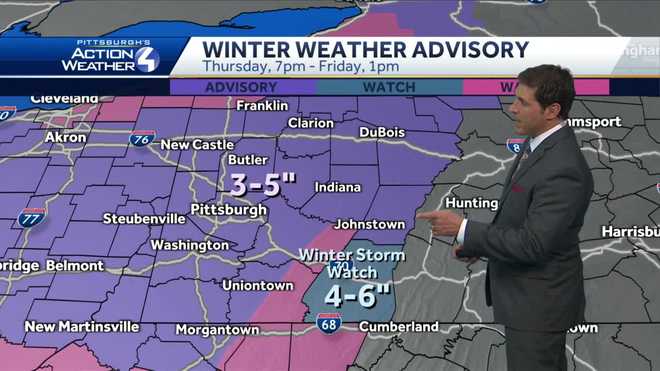
WTAE: 3-5″
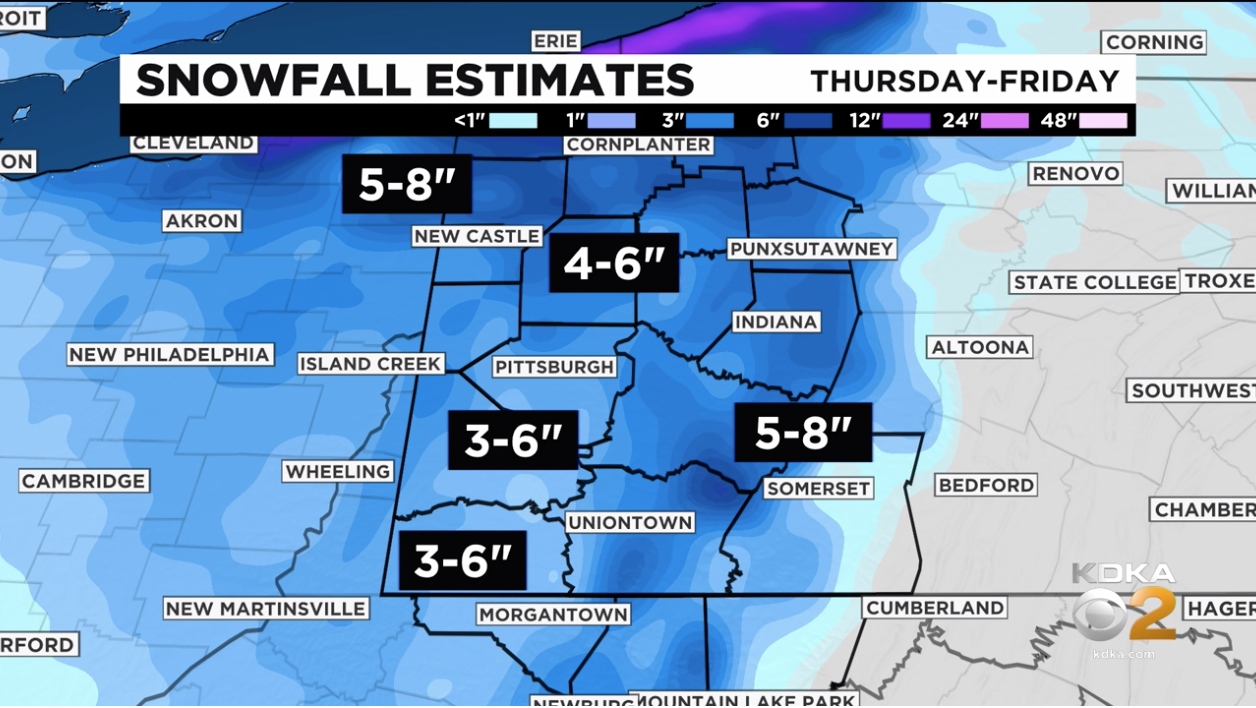
KDKA: 3-6″
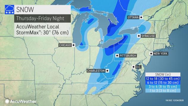
AccuWeather: 3-6″
Intellicast: 6-8″
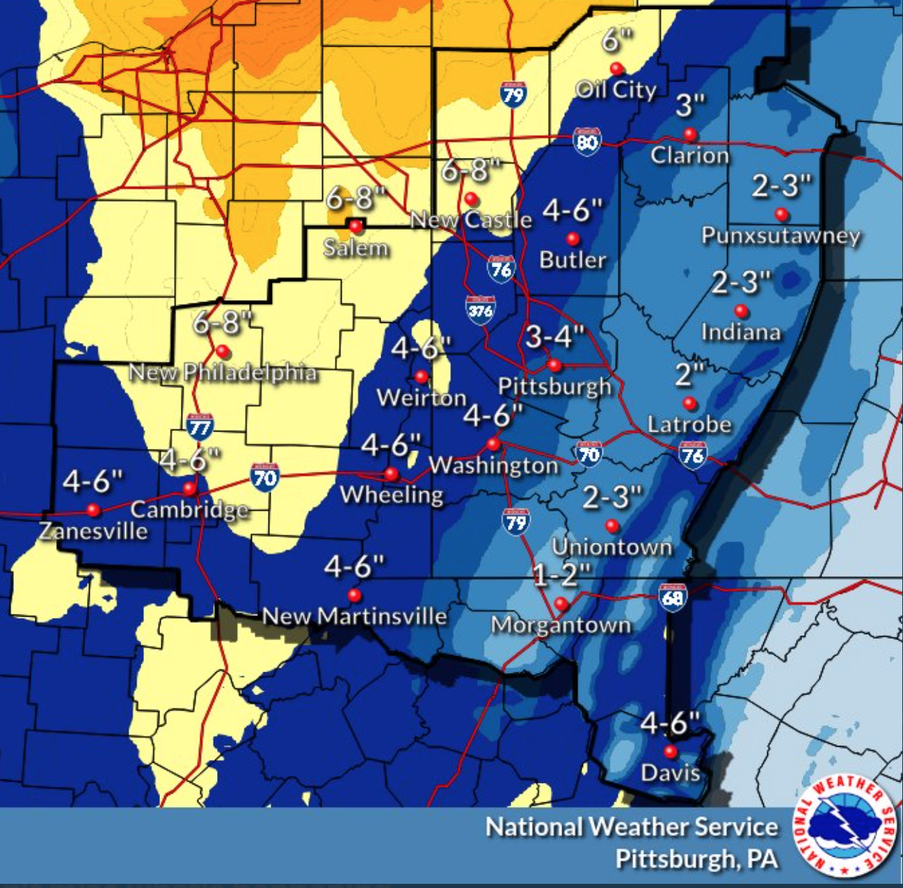
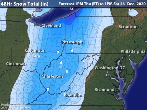
NWS Pittsburgh: 4-6″
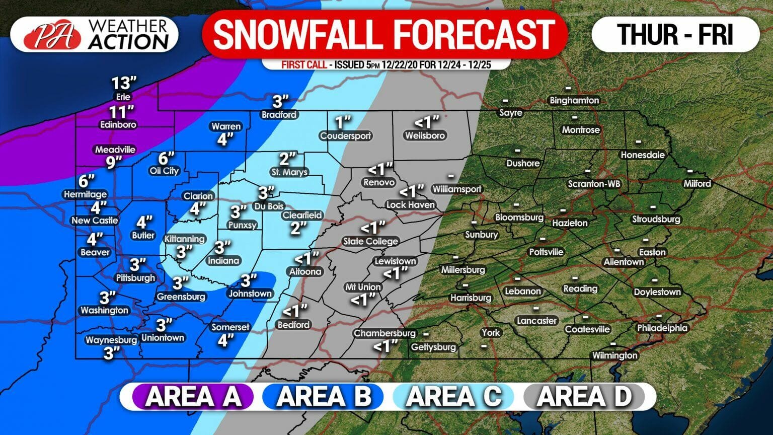
PA Weather Action: 3″ locally, 3-6″ Area B
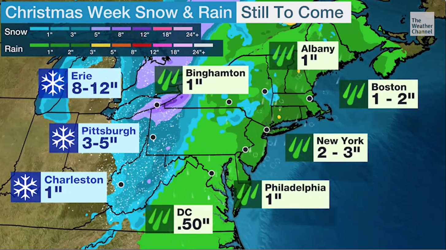
The Weather Channel: 3-5″
Be the first to comment on "Forecast Roundup for 2020 Christmas Snowstorm"