
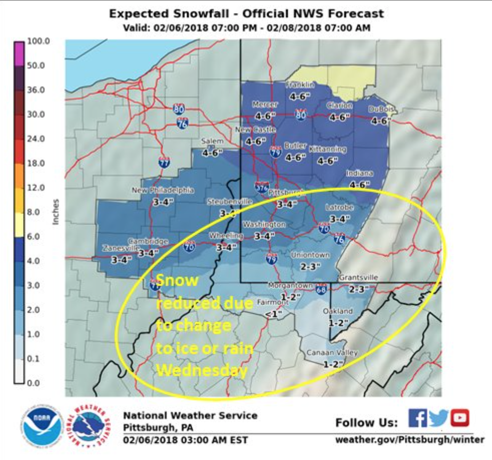
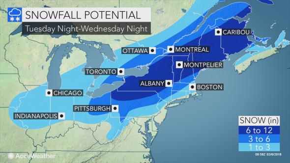
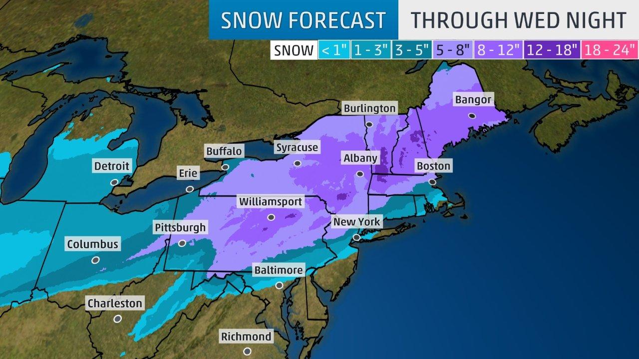
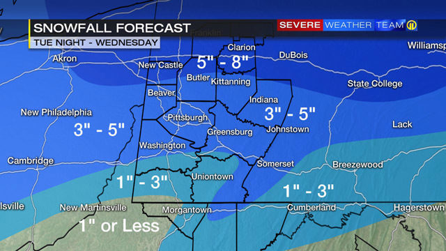
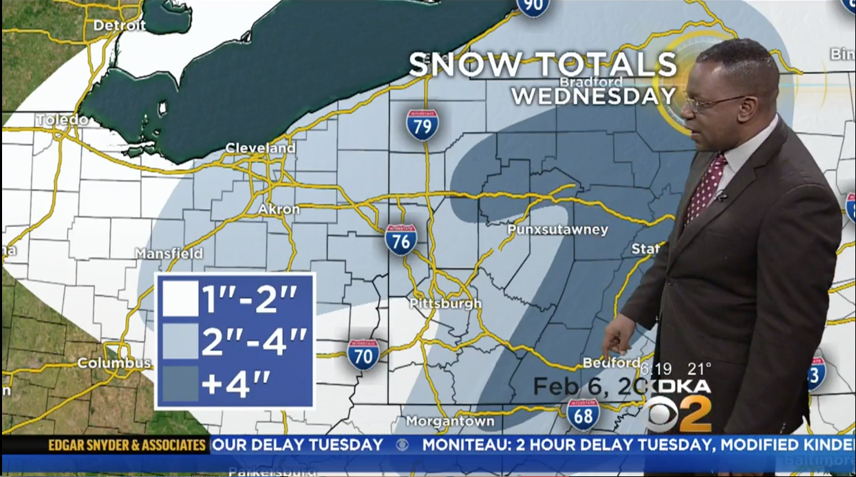
A messy winter storm of snow, sleet, and rain is bearing down on Western Pennsylvania, scheduled to arrive Wednesday during the early morning hours. That arrival time of before the AM commute will make predicting school delays and cancellations very difficult, as most forecasts are calling for a changeover to all rain sometime before noon. However, other forecasters are remaining confident that the rain-snow line will remain south of Pittsburgh for the duration of the storm. There is a wide range in snowfall forecasts because of the disagreement on how much mixing/rain we will see here in Allegheny County, so we are publishing this first look at the forecasts so we can track how they evolve throughout the day.
Some notes on the forecasts below:
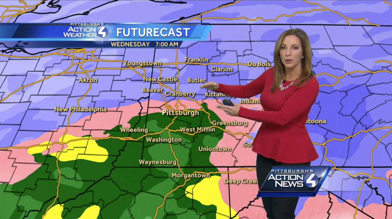
- WTAE did not show an accumulation forecast on their morning newscast, so we are showing how their Futurecast model is predicting an early change to all rain.
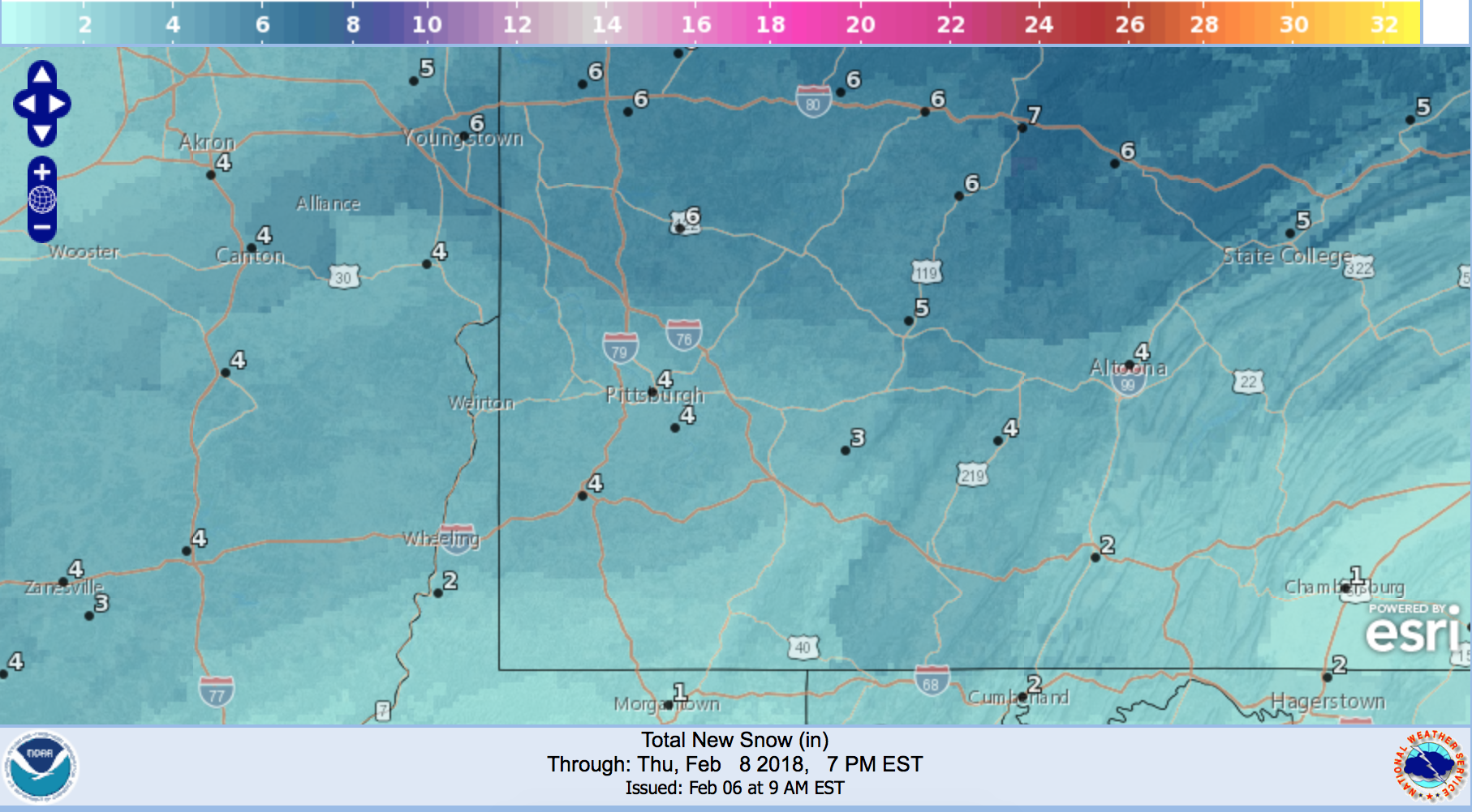
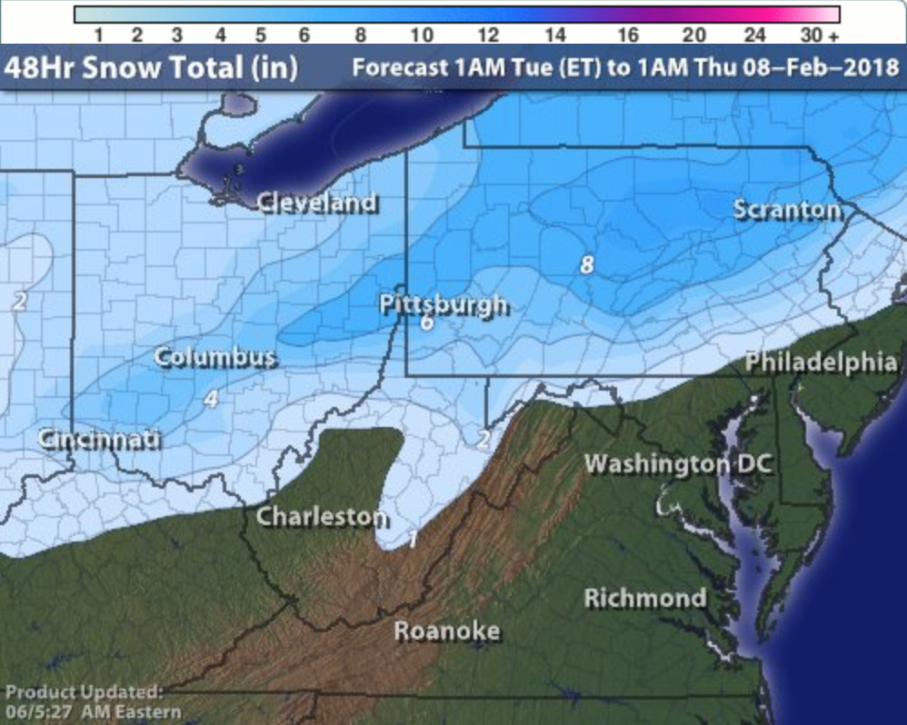
- The Weather Channel has already updated their map twice today, the one below is the most recent as of 10 AM. Earlier this morning, Pittsburgh was solidly in the 5-8″ range, and as you can see the city has been pushed down to a lower forecast total.
Be the first to comment on "First Look at forecasts for Wednesday’s Winter Storm"