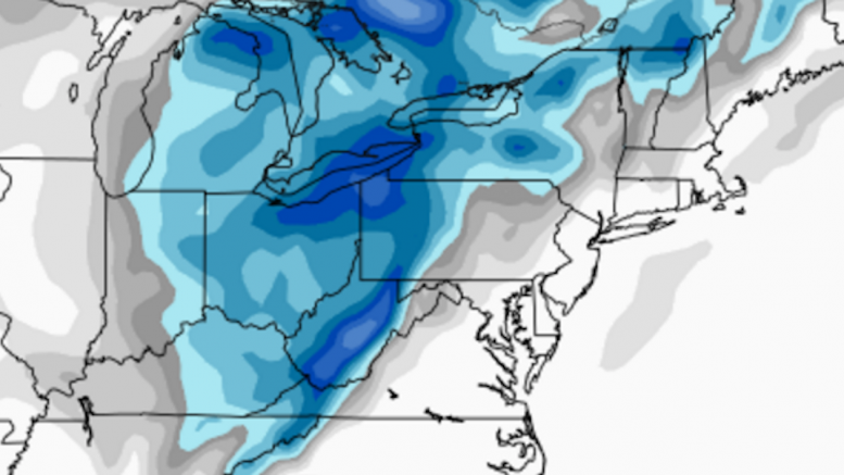
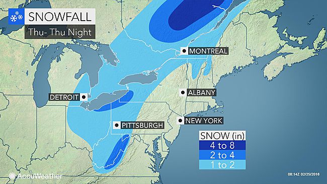
Once again, Western PA missed out on a big snowstorm thanks to a surge of warm southern air. Now, as the storm makes it way slowly to the north, it will be throwing back-side snow on the region. Although a large swath of moisture is not expected, scattered bands, with some bringing heavy snow, with pass over Western PA from Thursday morning through Friday morning.
Each predicted measurable snow event will have a roundup article like this one posted, so that you can view each network’s predictions for the storm. After the last flake has fallen, we will post an article inspecting who had the most (and least) accurate snowfall forecast in our Forecast Analysis. If you are looking for a specific map to trust for this complex weather event, AccuWeather earned a perfect 10/10 Accuracy Score on the last storm.
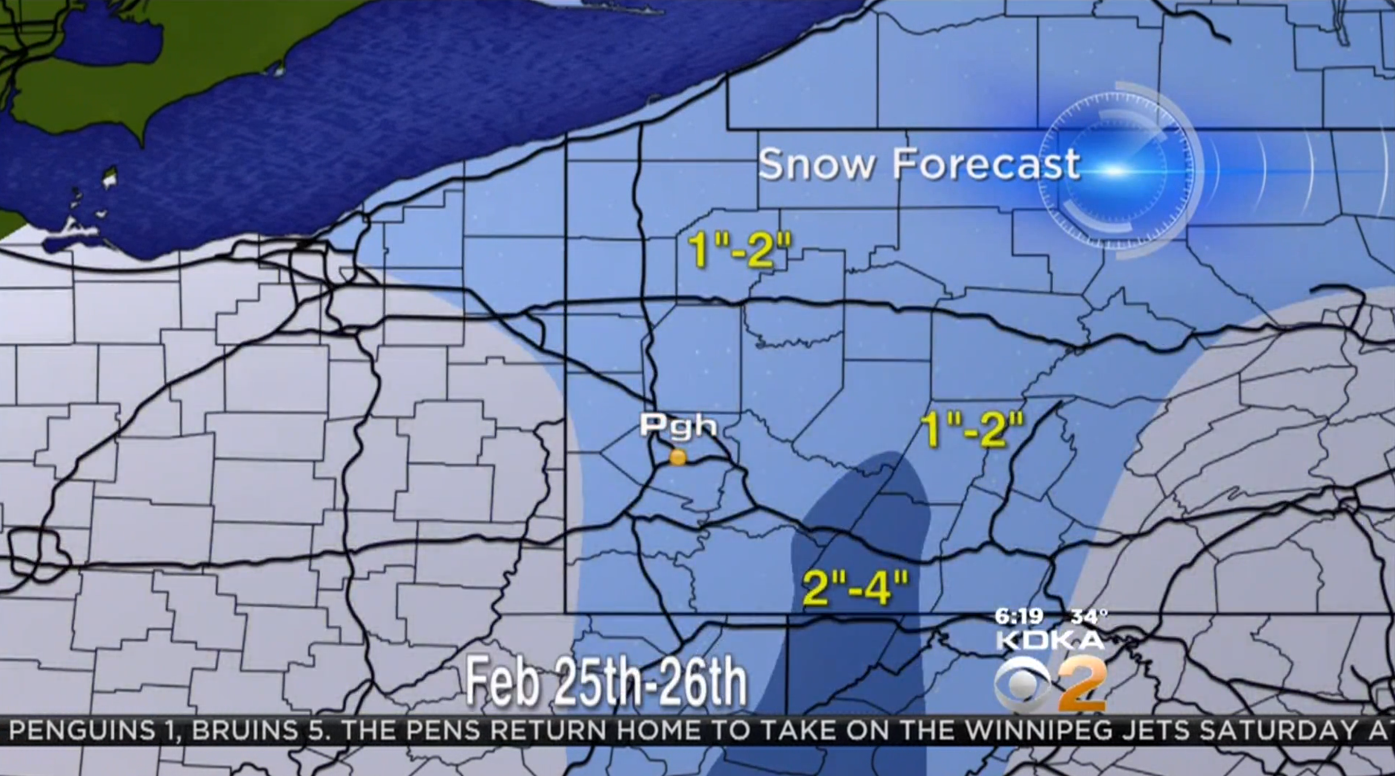
WTAE is simply using the National Weather Service’s Winter Weather Advisory zones as their snowmap. In the advisory? 2-4″ with 6″ or more possible in the Laurel Ridges. Not in the advisory? 1-2″.
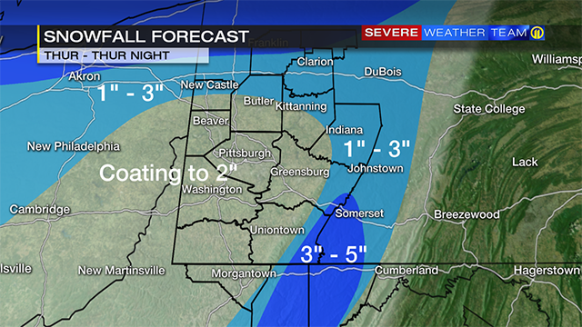
WPXI believes the highest snow total will be 5″ in the mountains. Most of the area will see a coating to 2″, with higher amounts of 1-3″ possible to the north and east of Pittsburgh.
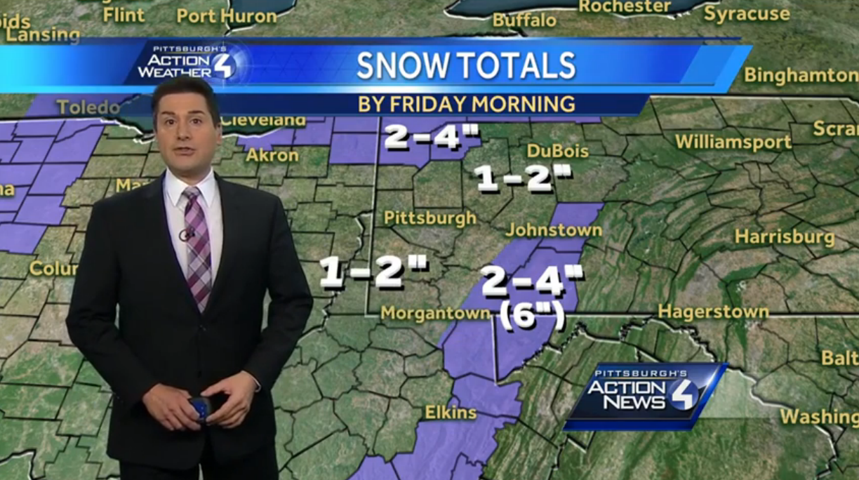
KDKA is far less impressed with the already light snow event. They cap snow at 4″ in the ridges, and expect everywhere else to see 1-2 inches.
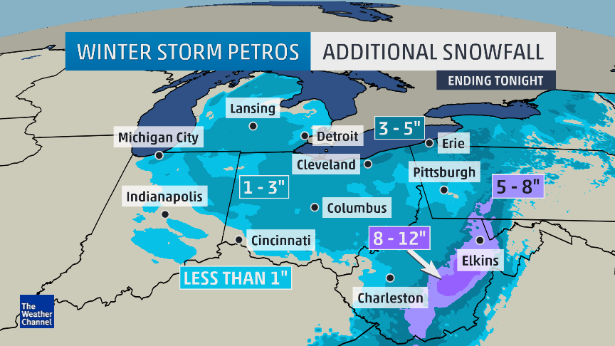
The Weather Channel expects a lot from this back-end snow. Although the typical “Western PA snow hole” restricts Allegheny County and surrounding areas to 1-3″, areas to the north and east will see 3-5″ according to this map. In addition, they also expect heavier accumulations in the ridges, totaling 5-8″.
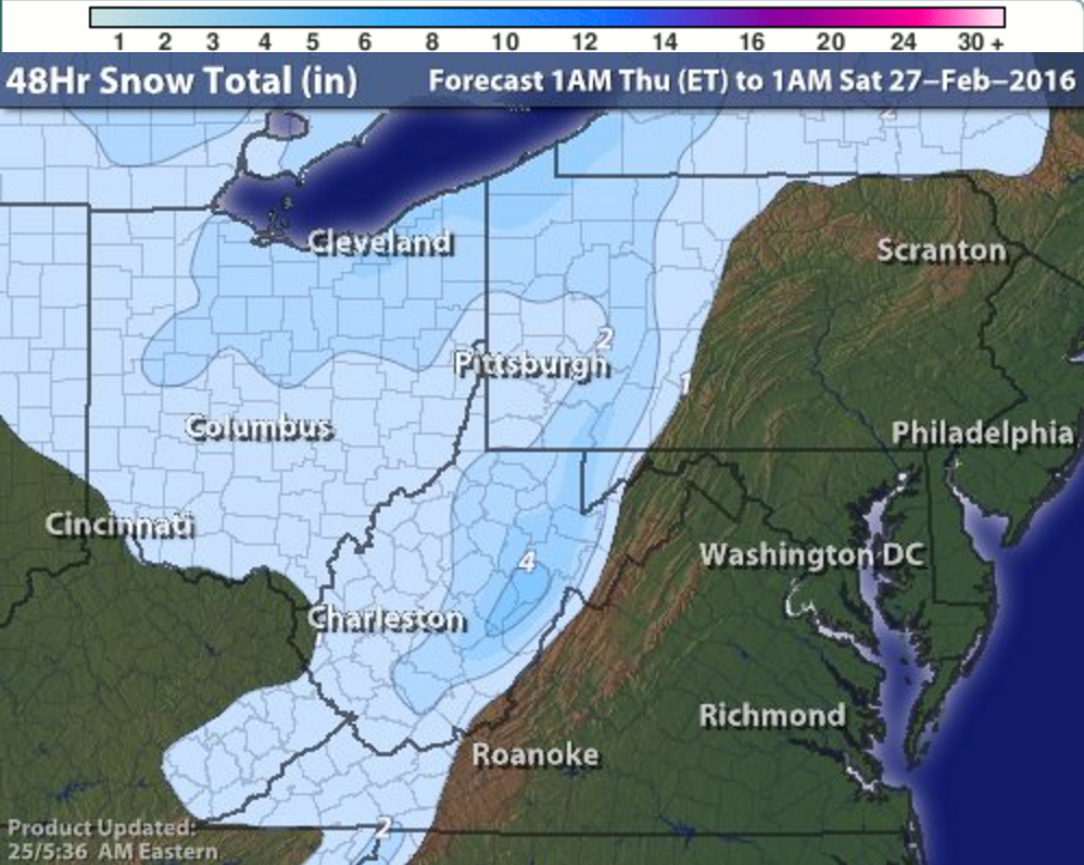
AccuWeather is very different than The Weather Channel’s map. They restrict nearly all of Western PA to 1-2 inches, not even expecting 2-3″ in those areas. This map does not think the Laurel Ridges see anything more than the rest of us, but they do expect lake-enhances snowfall of 2-4″ near Erie.
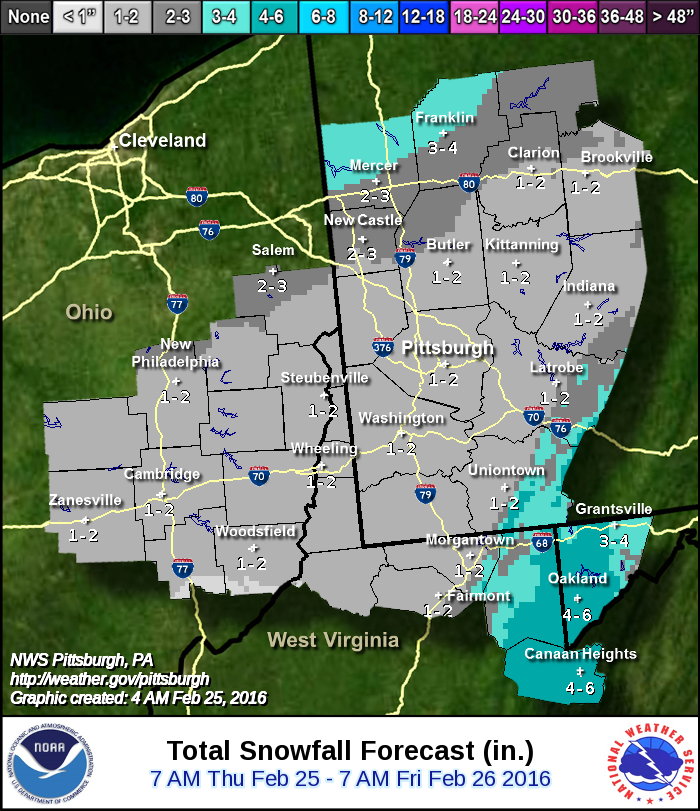
The NWS Pittsburgh Office has stuck with their 1-2″ prediction all week. The ridges will have a tight gradient of 1-2″ to 3-4″ to 4-6″, and like some other maps they expect higher totals near Lake Erie. However, the focus of this map is their forecast area, and 90% of that area is 1-2 inches.
Intellicast, which has long been one of our favorite forecast models, is low on snow. The entire region is enveloped in 1-2″, with most seeing just an inch or two. The ridges and lakeshore fall in the 2-3″ range, but all of Allegheny County is in 1-2″.
Be the first to comment on "Forecast Maps for February 25-26 storm"